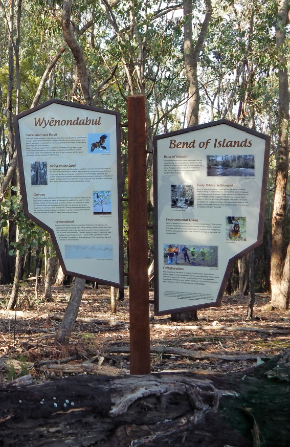
History
Aboriginal heritage
For thousands of years prior to the arrival of the first Europeans in Bend of Islands in 1840, the area had been home country to a remarkable people whose understanding of the region’s fauna and flora far outshone that of modern-day naturalists.
The clan estate of the Wurundjeri (or more specifically the Wurundjeri willam part of the Kulin Nation) extended beyond the present-day Bend of Islands, while around it were other equally knowledgeable clans and patrilines who knew every corner of their Country, and when and where best to harvest its wealth of wild-foods. Throughout the warmer months of the year these clans used the resources of the Yarra and its lower tributaries, and in the colder months moved into the warmer hill country above their cooler riparian domain.
As a people they had their own names for every hill and stream and noteworthy feature, most of which have long since been lost to our world. To the Wurundjeri, the Yarra had been Birrarung (the river of mists) flowing through Country they knew as Nillumbik (less good hunting ground), Yering (wattle scrub), Warrandyte (place thrown to) and the southern Christmas Hills, Wyenondabul (fiery hills).
The language of the Wurundjeri is Woiworung and the names they gave to their country were evocative of some distinguishing features within it. Today, we use many of their names that have survived.
Many of the Wurundjeri Dreamtime stories have survived to tell us how they understand their world to have been created, among them how all-powerful Bunjil the Eagle had once punished his people for breaking his lore by hurling a star down upon them. The place where the star struck (Buk-ker-til-ibul) is the tiny gorge at the confluence of Brushy Creek and the Yarra in today’s Wittons Reserve. The event gave rise to the name Warrandyte (‘warran’ – to throw and ‘dyte’ – the place thrown to).
Today’s four seasons, imposed by early settlers from Europe, run counter to the way the Wurundjeri had understood their world. In recent years a six-season Middle Yarra Timelines Calendar has been developed to more accurately reflect seasonal changes in the region’s flora and fauna.
John Batman described the local clan after he had visited their encampment on the Plenty River on 6 June 1835 (in a failed attempt to purchase their hunting grounds) as comprising 20 men, 20 women and 22 children. A similar number of the Wurundjeri willam are understood to have occupied Bend of Islands in the colder months of the year.
Interaction between the Aboriginal and European worlds of the Middle Yarra appears not to have been characterised by untoward violence. The Ryries at Yarra Glen, James Murray (Christmas Hills and Bend of Islands), and James Dawson (Wonga Park and Jumping Creek) all appear to have maintained good relations with the Wurundjeri. On the other hand, James Anderson at Warrandyte and Major Newman at Templestowe were not so friendly with the Aboriginal people.
Wurundjeri numbers declined rapidly in the 1840s, mainly due to introduced disease, lack of sufficient hunting territory and loss of heart and culture. When their government Protector, William Thomas, visited the Ryrie Station (today’s Chateau Yering) in the 1840s, he sketched the surrounding hills, writing the names of each hill as told to him by a Boonwurung man, Kurburu. Above the Christmas Hills and elsewhere he wrote the ominous words ‘all gone dead’. The name given for Bend of Islands that day was Wye nondabul.
The last account of Kulin people hunting in Bend of Islands also comes from William Thomas. On Sunday 23 March 1851 he recorded in his weekly report:
‘16 Taungurong men on the north bank by a large lagoon, fishing (or more properly speaking, spearing) eels some almost dry upon the rocks or falls’.
Today the lagoon he refers to is within The Heritage Golf and Country Club, beyond the end of Henley Road.
We owe much to the region’s Wurundjeri people who had cared for Bend of Islands so sustainably over the millennia. Recent archaeological surveys of Bend of Islands have provided today’s people with further insights into their lifestyles. We have much to learn from seeing the land through Aboriginal eyes.
The Wurundjeri are not gone. Their descendants continue to live in the Yarra Valley and recently have established ties with our community, and thousands of their old people still lie buried in Bend of Islands bush.
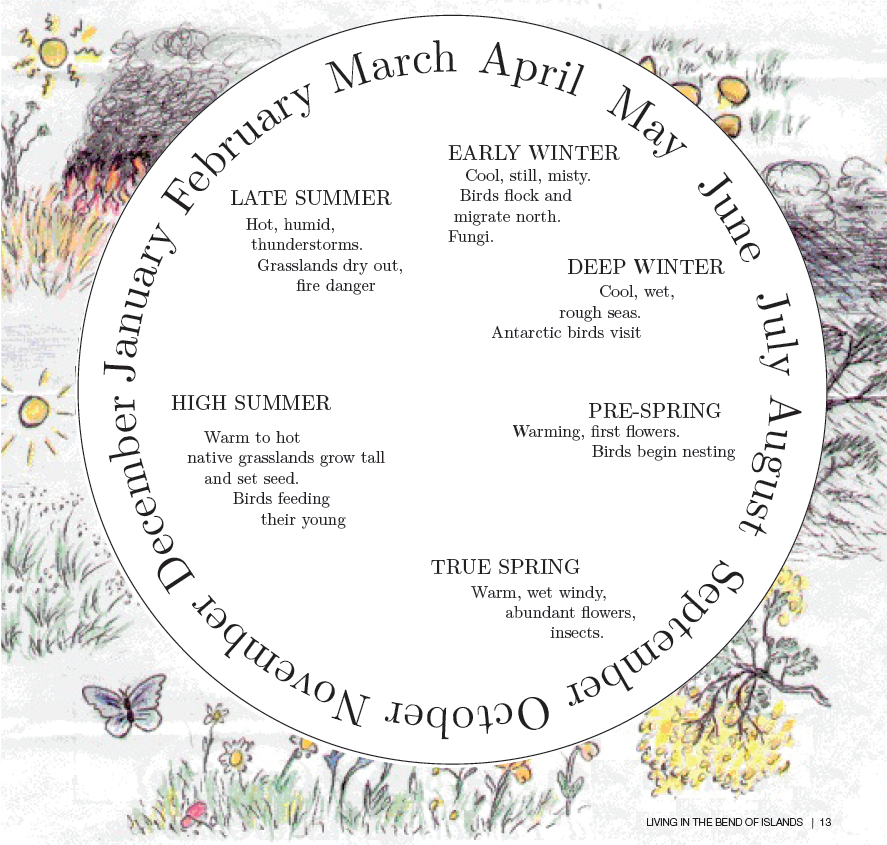
Indigenous Calendar
Wurundjeri had their own way of marking the changing seasons. The European division of the year into four seasons does not fit the Melbourne area.
We still think of winter as an unfavourable time when deciduous trees drop their leaves and become dormant, but for our native flora, especially the small tuberous herbs, it is a season of growth. The bush is green and the temperatures mild. The unfavourable season is summer when much of the ground flora becomes brown and dies off. Water plants such as Cumbungi are usually green in summer and die back in winter.
This indigenous calendar for the Wurundjeri people was compiled by Beth Gott and the artwork is by Damian Curtain.
The 19th Century
Bend of Islands was probably part of the Kangaroo Ground pastoral run, occupied by squatters named Brown and Draper, until the 1860s. After gold was discovered at Andersons Creek in Warrandyte in the 1850s, prospectors ranged along the length of the Yarra, and Bend of Islands was not spared their attention, although activity seems to have been confined to the lower slopes along the river. After the passing of the Lands Act 1860 most of the pastoral run was divided into freehold allotments, and in 1885 James Page purchased allotments 41B and 43 in the Parish of Sutton, totalling about 320 acres. A riparian strip of land 150 links wide (about 30 metres) was permanently reserved as Crown land for ‘public purposes’ in 1889.
1910s – 1950s
Bend of Islands probably did not escape the widespread cutting of timber for fuel wood in the early part of the 20th century, particularly during World War 1 when fuel wood for industrial steam engines and domestic use was in great demand.
The establishment of Bend of Islands as we know it today began with the Haughton family, who early in the century owned allotments 41B, 43 and 46A. In today’s language this is best described as all that land south of Henley Road, except that referred to in the 1970s as the ‘top-end blocks’ (i.e. those blocks with a frontage to Henley Road between its two intersections with Catani Boulevard). This land had come into the ownership of Agnes Haughton (a daughter of E.H. Cameron MLA) in September 1924 after having first been leased from the Page family by other members of the same family since about 1912.
In early 1929 Edward (Ned) Haughton, applied for and was granted a plan of subdivision for that part of the three allotments with frontages to present day Catani Boulevard, Gongflers Drive and Ironbark Road. This subdivision effectively divided the Haughton land into 35 blocks, averaging around five acres apiece, plus a central core block of some 124 acres.
With his plan of subdivision approved on 8 March 1929, Haughton set about the construction of Catani Boulevard, Gongfl ers Drive and Ironbark Road.
In order to provide its main thoroughfare, Catani Boulevard, with a better approach from the Kangaroo Ground side, Haughton came to an arrangement with Catherine Oxley, the owner of the 65 acres between the bridge and the Yarra, that allowed him a road reservation across the eastern end of her land (best described today as that part of Catani Boulevard with a frontage to the Oxley Reserve), in return for upgrading the Watson Creek Bridge — at the time a rickety wooden affair subject to winter flooding.
This road reserve then became the ‘gateway’ to the Haughton subdivision.
The estate had been first placed on the market sometime prior to April 1929 as the Glen Agnes Estate. However, because of the Great Depression of the 1930s and consequent difficulties in marketing the land, Haughton had renamed it the Glen Agnes Bend of Islands Estate and finally, simply Bend of Islands Estate.
Unsold five-acre lots with river frontage were selling for £50 in 1938, but the price had risen to £80 by 1940. They were described as ‘lovely timbered Camp Blocks’.
In 1942 two large allotments of 200 and 93 acres were offered for auction by Ned Haughton, probably the ‘core’ of the estate that was subsequently subdivided into relatively large allotments.
The early 1960s
Bend of Islands had already been subdivided, in many cases into unsuitably small lots. The buildings were mostly weekenders, although there were a small number of permanent dwellings.
The entire area burnt in 1962 and most houses were destroyed.
Mid 1960s
A new interest in the area was aroused when artist and naturalist Neil Douglas purchased his property. People who were attracted to the area by its environmental and aesthetic qualities bought a number of properties.
Late 1960s
Residents were concerned when fire protection authorities demanded in 1968-69 that landowners bulldoze their blocks for fire safety. The Bend of Islands Conservation Association (BICA) was formed and its committee worked with the Shire of Healesville and the Country Fire Authority to establish fire prevention measures acceptable to all. Resident awareness regarding both fire safety and wildlife management developed.
The Melbourne Metropolitan Board of Works (MMBW) proposed the construction of Yarra Brae Dam and began compulsorily purchasing properties in Bend of Islands. BICA became involved in anti-dam activity. The community realised that to successfully oppose the dam they must convince authorities of positive environmental qualities in the area.
Early 1970s
The Yarra Brae Action Committee was formed in 1972 with wide community representation, including the Bend of Islands Conservation Association (BICA). Residential conservation ideas were formulated. A booklet titled ‘Residential Conservation’ was published in 1975 under the auspices of the Australian Conservation Foundation (ACF).
Mid 1970s
In April 1974, the MMBW published an Environmental Impact Study on the proposed Yarra Brae, Sugarloaf and Watsons Creek dams, to which the public was invited to make submissions. BICA had a large input to this. Due to public opposition, the proposed Yarra Brae Dam was abandoned later that same year.
Late 1970s
At a public meeting held during October 1976 in Kangaroo Ground, residents and landowners voted in favour of a new zoning to protect Bend of Islands. Proposals were made for an Environmental Living Zone (ELZ) for incorporation into the Shire of Healesville's Planning Scheme and Interim Development Order (IDO).
1980s
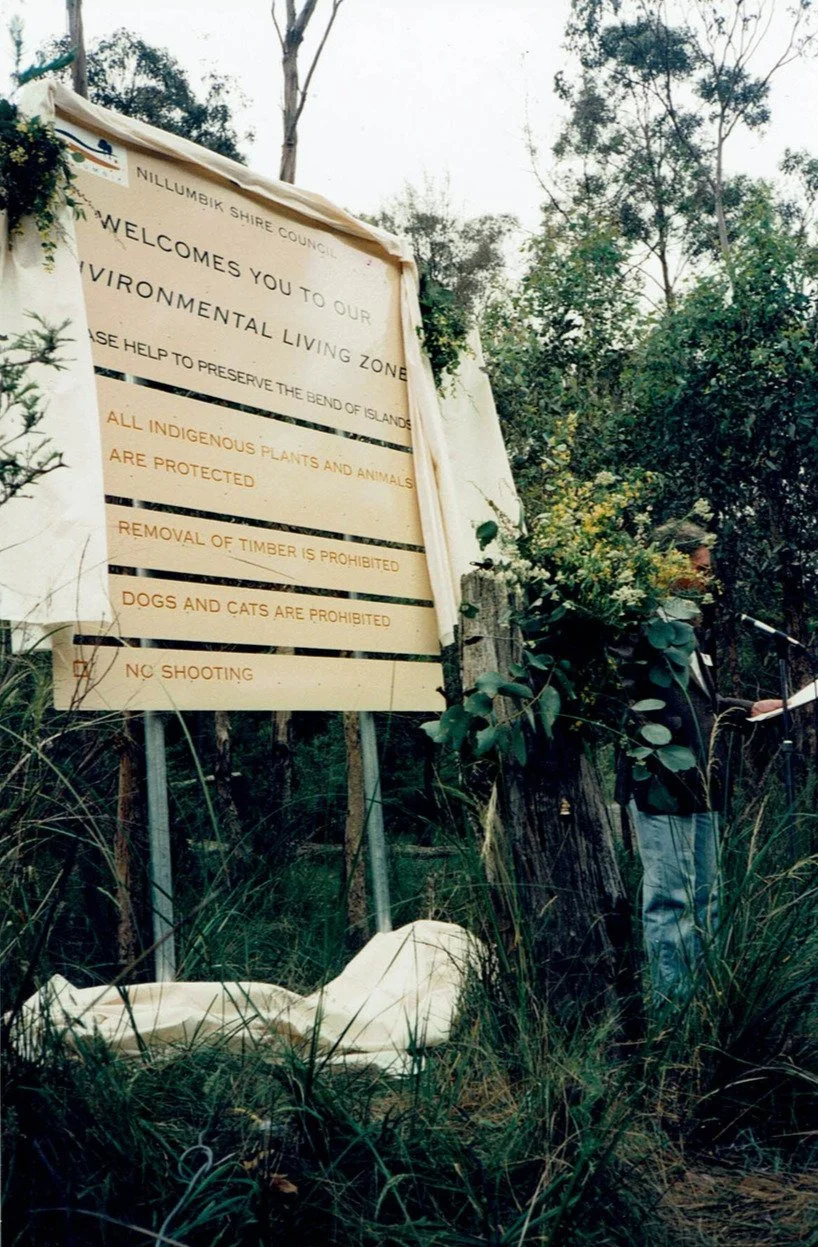
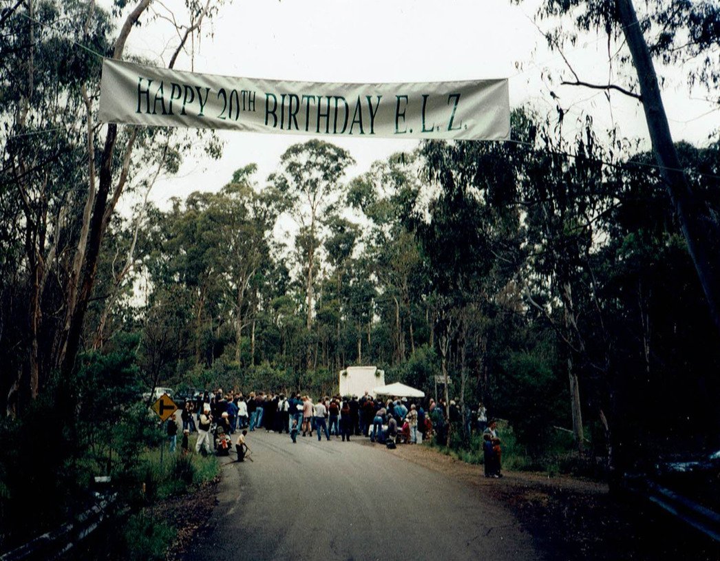
In September 1982 the Victorian Government Gazette proclaimed the Healesville IDO thereby designating Bend of Islands Victoria’s first Environmental Living Zone.
The Environmental Living Zone was officially opened in October 1982 by the Minister for Conservation, Evan Walker, when he cut a symbolic native fl oral ribbon placed across the Oxley Bridge at Watsons Creek.
See Timeline of ELZ for more detail.
1990s
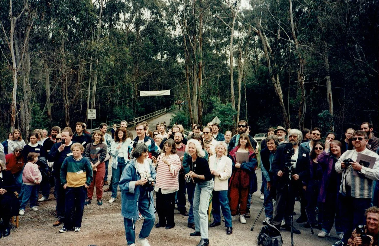
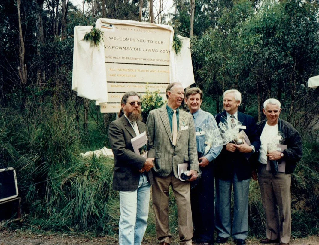
The twentieth anniversary of the proclamation of the IDO that established the ELZ was celebrated in November 1996. The Minister for Planning, Rob McClelland, unveiled a new sign for the area in front of an audience of local residents and guests, including many of the people who were at the 1982 celebration.
A petition from local residents resulted in the name ‘Bend of Islands’ being accepted and gazetted by the State Government in June 1999. Later that year, the Shire of Nillumbik approved the establishment of the ‘Schedule 2 to the Special Use Zone (SUZ2) Environmental Living – Bend of Islands’ in its planning scheme.
2000s
The new format State planning scheme was approved in June 2000 and included the ‘Nillumbik Special Use Zone 2 (SUZ2) Bend of Islands/Environmental Living Zone’.
To celebrate the gazettal of the new format planning scheme SUZ2, and the acceptance of the name ‘Bend of Islands’ for the area, a gathering of local residents and guests in December 2000 saw the Member for Yan Yean, Andre Haermeyer, and Mayor Marg Jennings, unveil a revised sign including the words ‘Bend of Islands’.
On 4 October 2005 approximately four hectares of land at the end of Gongflers Drive was officially named the Neil Douglas Nature Conservation Reserve. The official ceremony was attended by the then Deputy Premier, John Thwaites, local politicians, representatives of Melbourne Water, Nillumbik Shire Council, Department of Sustainability and Environment and the press.
This land is preserved as a passive reserve with no public activities or facilities, and is a fitting tribute to Neil Douglas, who passed away on 25 October 2003. ‘Duggo’ was a visionary whose concept of residential conservation has become Bend of Islands as we know it today.
From October 2005 to February 2006 the transfer of Melbourne Water properties within, and adjoining, Bend of Islands was completed. The Yanakie property was transferred to the Department of Sustainability and Environment to become part of the Kinglake – Warrandyte Nature Conservation Corridor.
In early 2006 the remaining Melbourne Water blocks of land within Bend of Islands were covenanted with Trust for Nature and placed for sale on the open market.
2010 – present
Beginning in 2012, a partnership was formed with the Wurundjeri Tribe Land Compensation Cultural Heritage Council to improve the local environment, protect endangered species, build experience and capacity for the Wurundjeri Narrap (Country) Team, bring indigenous and non-indigenous communities together and increase understanding of indigenous values and history in the Bend of Islands community.
An important milestone in the development of management to maintain the ecological integrity of Bend of Islands was the launch of the Bend of Islands Land Management Plan in April 2013.
This plan provided an inventory of the quality and variety of flora at that point in time, along with weed species and other threats to the biodiversity in the area. It also modelled land management plans for a number of individual properties within Bend of Islands.
Following the Wurundjeri Collaboration Project in 2012, the Nillumbik Shire’s ‘Welcome to Bend of Islands’ sign was replaced in December 2014 with a new sign that included the words:
‘Nillumbik Shire Council respectfully acknowledges the Wurundjeri as the original custodians of this land that we now call Bend of Islands in the area known to the Wurundjeri as Wyenondabul.’
Universally recognised graphics were also included to clearly show some of the ways to preserve this unique environment.
The ongoing relationship between the Bend of Island community and the Wurundjeri community has continued through Clean Up Australia Day activities. In March 2016, an interpretive sign acknowledging the Traditional Custodians of Bend of Islands was unveiled on the Upper Catani/Henley Road corner. Wurundjeri Elders, Dave Wandin and Aunty Di Kerr welcomed people to Country.
Geology
An understanding of ecology begins with the land. Bend of Islands is what it is today by virtue of its geological history, soil types, drainage systems and climate, and the interaction between its component parts. Its fauna and flora are site-specific, and the district’s geology largely determines what organisms live where, be they animals, plants, or indeed ourselves.
It all began eons ago off the shores of Gondwana when, over tens of millions of years during the Silurian Period, sediments were deposited beneath an immense shallow sea and gradually formed a deep layer of sedimentary rock several kilometres thick. A massive uplift in the Devonian Period (about 350 million years ago) and subsequent east–west compression of the crust raised these Silurian rocks into a high mountain range, which over further eons in this part of Victoria was eroded down to a relatively featureless plain sloping gently towards the south-west.
Across this so-called ‘Nillumbik Terrain’ flowed a large river, known to geologists as the Wurundjeri River, which deposited extensive beds of sand and water-worn gravels that can still be seen in different parts of Kangaroo Ground.
The Triassic Period (200 million years ago) led to further changes. Volcanic activity to the west of Bend of Islands saw extensive beds of lava flow across Kangaroo Ground and Greensborough, although not reaching Bend of Islands. But the most significant event for Bend of Islands was the reactivation of the long-quiescent Yarra Fault only a few million years ago in the Pliocene or Pleistocene, slowly lifting Bend of Islands and the land to its immediate west high above the Yarra flood-plain to its east. This uplift happened so slowly that the Yarra was able to maintain its previous course in Bend of Islands, gradually cutting down through the rising block.
This event also led to the rejuvenation of the streams on the uplifted block and located the Yarra and primeval Watsons and Diamond Creeks where they are today. Over the last few million years this new stream system has been cutting deep into the soft sandstones, siltstones and shales of the Nillumbik Terrain, forming the steep slopes that characterise Bend of Islands and depositing a deep, rich layer of alluvial soil in the valleys. These alluvial soils were heavily prospected for gold in the 1850s, after the opening of the Andersons Creek goldfield, but probably with little success in Bend of Islands as there are no records of significant gold finds in the area.
Today Bend of Islands is characterised by a relatively young, steep and still-eroding landscape. Soils are thin and most of the upper horizon would have been washed away as a result of grazing, clearing and fire in the last 180 years.
Newsletter Archives
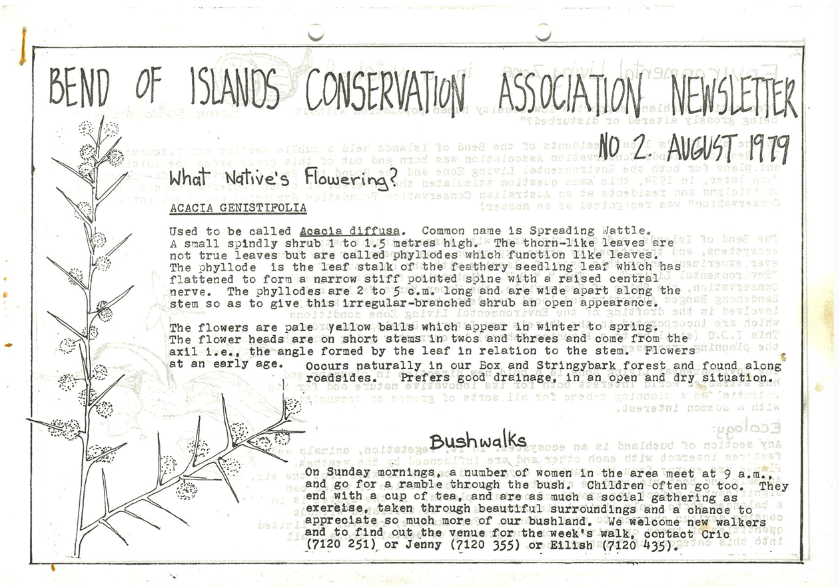
Explore BICA newsletters from the beginning in 1979.

The Environmental Living Zone
Read a concise timeline of the Bend of Islands’ ELZ.

About BICA and the Bend
Learn more about the Bend of Islands and BICA